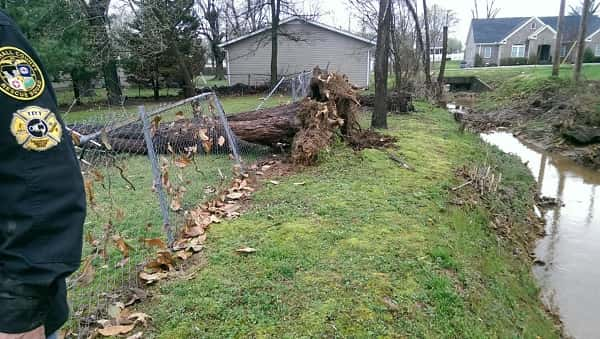
 UPDATE 5:05:54 PM: National Weather Service Warning Coordination Meteorologist Rick Shanklin has confirmed to Marshall County Emergency Management that a microburst measuring 80 mph hit Calvert City and a microburst measuring 70 mph hit Gilbertsville this morning during a pattern of strong storms that moved through the region.
ORIGINAL STORY: Strong Line of Storms Leaves Trail of Damage Behind Friday Morning
CALVERT CITY – While the county remains under a tornado watch until 9 p.m., a strong line of storms that moved through the area this morning around 9 a.m. caused minor damage to several properties in the Calvert City and Gilbertsville areas.
Marshall County Emergency Management Director Frank Murphy and Rescue Squad Chief Curt Curtner toured areas around the county this morning looking to rule out any possible tornado activity associated with the storms.
After surveying the damage and consulting with the National Weather Service, it was confirmed that based on radar images and the debris field that the damage was a result of 50 to 70 mph straight line winds. More strong storms are expected this afternoon. Residents are encouraged to stay tuned to their weather radios for severe weather alerts.
The photo gallery below assembled by survey teams illustrates the damage done by high winds.


All articles loaded
No more articles to load