 The National Weather Service in Paducah is cautioning residents to prepare for another potential round of snow and frigid temperatures beginning tomorrow.
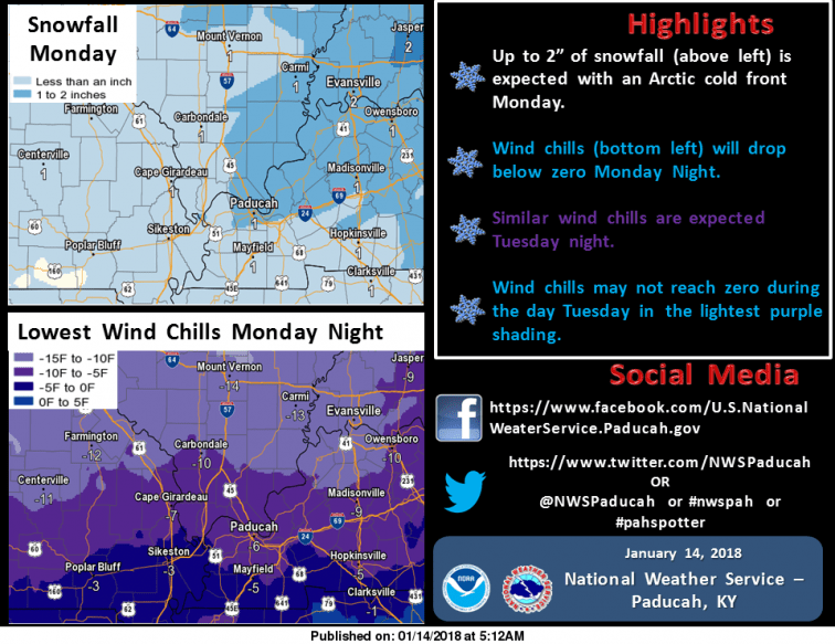
According to NWS, snow accumulation is expected to move through the region Monday, Jan. 15, with most areas east of the Mississippi River to get at least an inch. Some areas could see as much as 2 inches of snow accumulation, though the heaviest concentration anticipated to come near the Evansville Tri State.
With that system residents will likely see even colder air Monday through Tuesday night, NWS forecasters say. Temperatures will drop into the single digits Monday and Tuesday night; highs are expected to reach only in the teens on Tuesday.
According to NWS, wind chill readings will drop below zero throughout the region both nights. However, the coldest conditions are expected along and north of the Highway 13 corridor in southern Illinois eastward through
the Evansville Tri State, where the wind chill may drop as low as 15 below zero both nights. Wind chills in these areas may not climb above zero during the day Tuesday, forecasters say.
“Slick driving conditions are likely to develop across the region Monday, and with the extreme cold expected, conditions are not likely to improve much until Wednesday,” NWS special weather statements say.
For more information, visit NWS online.