 The National Weather Service out of Paducah has issued an Ice Storm Warning.
A significant wintry precipitation event is expected to return
across the Quad State later tonight and persist through Thursday.
At this time, significant and dangerous ice accumulations are
expected by Thursday morning, especially over parts of west
Kentucky, the southern tip of Illinois, and the Delta region of
southeast Missouri. However, notable ice accumulation is possible
over the remainder of southern Illinois, southeast Missouri, and
southwest Indiana.
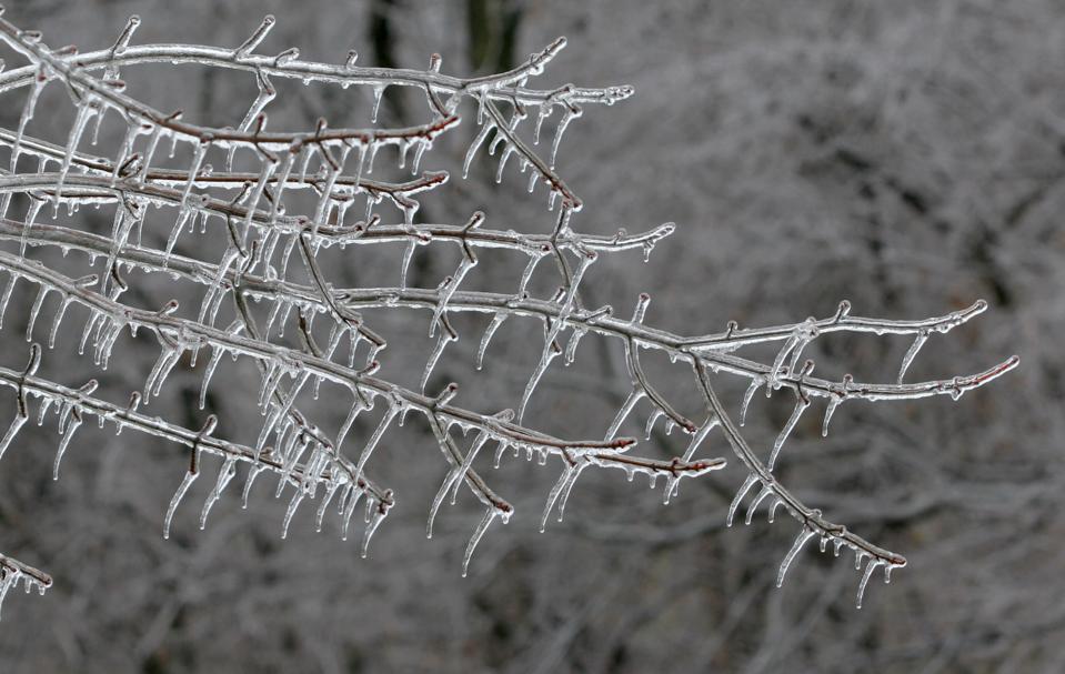
ICE STORM WARNING IN EFFECT FROM MIDNIGHT TONIGHT TO 6 PM CST
THURSDAY...

* WHAT...Significant icing expected. Total ice accumulations of
  two tenths to a half inch possible with the highest amounts
  along the southern portions of the Kentucky Pennyrile and
  Purchase Area. Additionally, up to a quarter inch of sleet is
  possible Thursday.

* WHERE...Along and south of a line extending from Doniphan,
  Missouri, northeastward to Eddyville, Illinois, then eastward
  to Calhoun, Kentucky.

* WHEN...From midnight tonight to 6 PM CST Thursday with most of
  the precipitation occurring Wednesday night through Thursday.

* IMPACTS...Power outages and tree damage are possible due to the
  ice. Hazardous travel conditions are expected and could impact
  the morning or evening commute.
PRECAUTIONARY/PREPAREDNESS ACTIONS...
Travel is strongly discouraged. If you must travel, keep an extra
flashlight, food and water in your vehicle in case of an
emergency. Prepare for possible power outages. Monitor the latest
forecasts for updates on this situation.