Area meteorologists and emergency personnel have been preparing for the possibility of excessive rainfall and associated flash flooding that could occur.
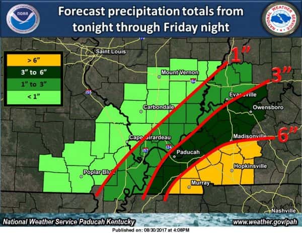
According to the National Weather Service in Paducah, anywhere from 4-6 inches of rain can be expected throughout parts of the county, with heaviest concentration expected south of Benton. NWS this morning issued a flash flood watch through Friday for portions of western Kentucky, including Marshall County.
Excessive rainfall can cause rapid rising of creeks and flooding in low lying areas.
Residents can also expect winds of about 20-30 mph beginning this afternoon, increasing tonight with gusts up to about 40 mph expected, according to NWS. A lake wind advisory is in effect through Friday, as well. The potential for isolated thunderstorms and tornadoes is also a possibility, though forecasters say not likely.